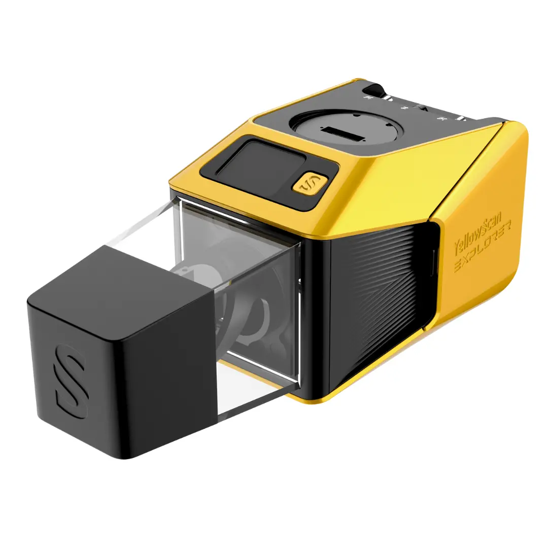
Description
Built for survey and government missions where there is no second chance to fly, the YellowScan® Venturer is an NDAA-compliant, survey-grade LiDAR system designed to remove uncertainty in the field. It gives confidence at takeoff, reliable results and full control over locally processed data through Cloudstation software.
What the Venturer Delivers
- Survey-Grade Performance: Even in challenging and poor GNSS environments
- Fully Local Data Processing: YellowScan’s Cloudstation keeps you in control of your data
- Flexible Scanning Modes: Full 360° coverage to capture vertical detail or 120° Burst Mode to concentrate points for maximum density
- Seamless Integration: Across professional UAV fleets, avoiding platform lock-in
- One Versatile System for Multiple Missions: Maximizing ROI and time efficiency
Built for Critical Missions
- Fully NDAA Compliant: Designed and manufactured in France, the YellowScan Venturer is fully NDAA compliant and processes data locally through CloudStation, giving operators complete control over their sensitive data while meeting strict security and compliance requirements.
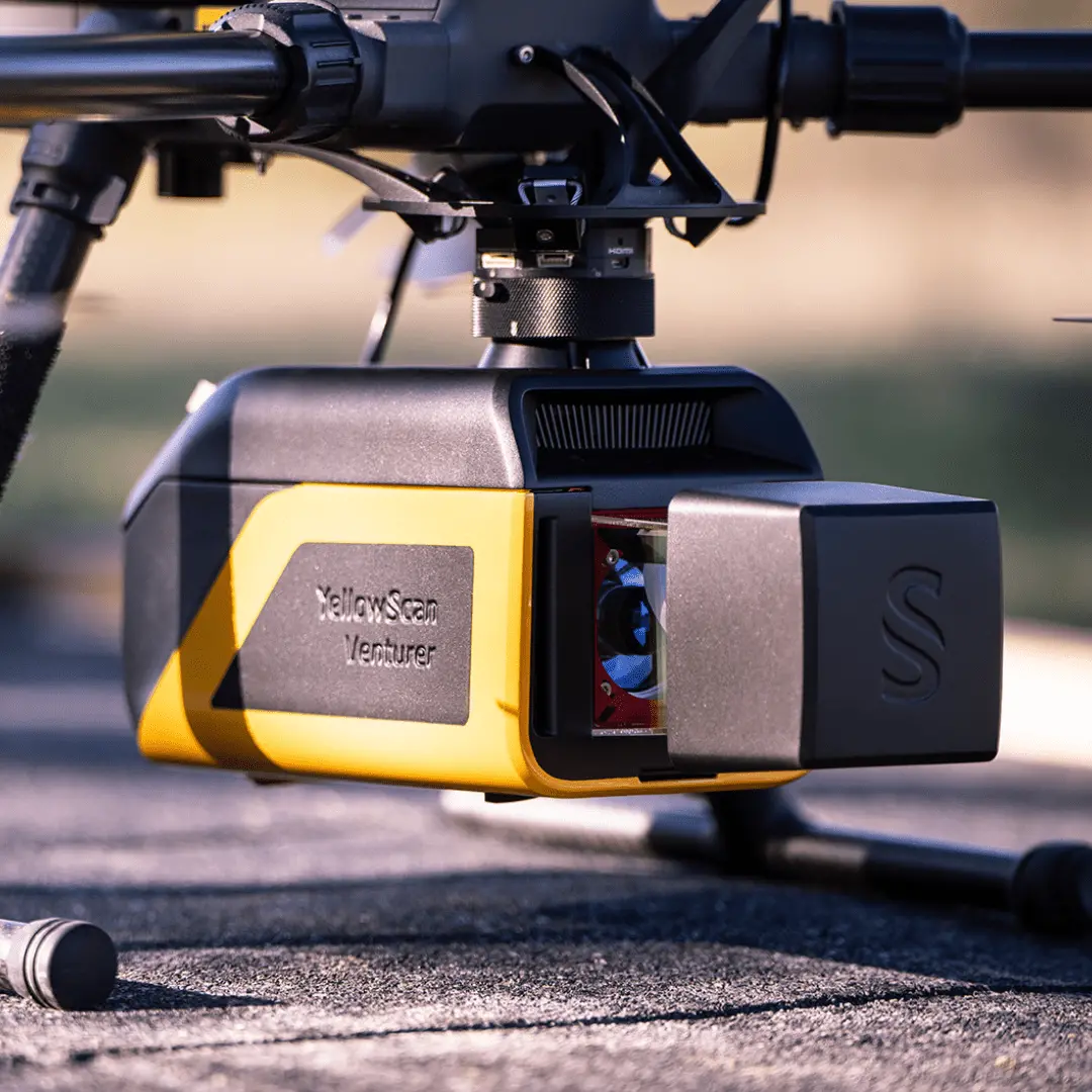
- UAV Compatibility: Weighing 2.45 kg, the Venturer uses YellowScan’s Quick Release Adapters for fast, tool-free integration across a wide range of UAVs. This ensures reliable power and data while reducing integration costs, avoiding platform lock-in, and maximizing long-term ROI.
- Survey-Grade Performance: Powered by the RIEGL Mini-VUX 3 UAV scanner and Trimble Applanix APX-RTX IMU, the Venturer delivers reliable positioning in poor GNSS conditions. Real-Time RTX corrections increase confidence in flight and reduce repeat missions. Advanced post-processing with POSPac Complete further improves robustness and accuracy.
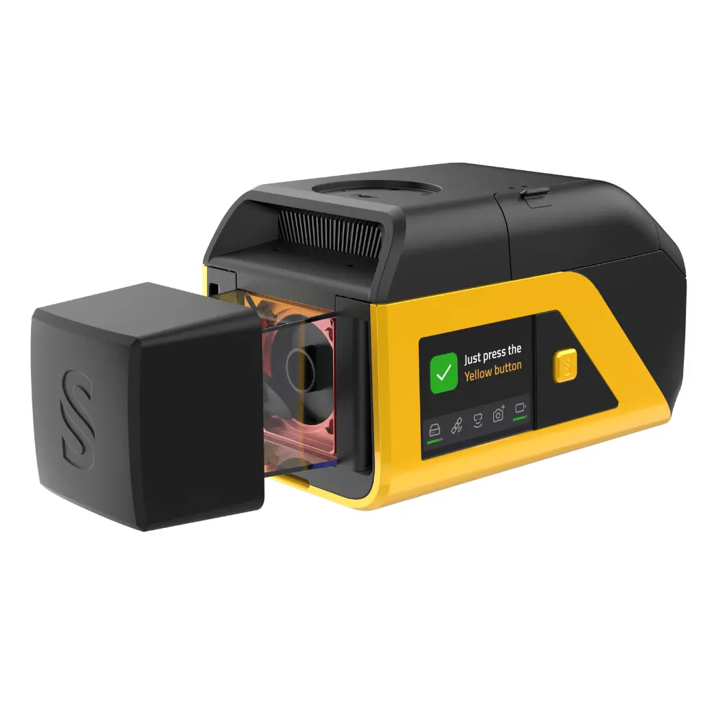
- Instant Readiness | Fly With Confidence: As soon as the Venturer is powered on, system readiness is instantly visible on the high-brightness Yellow Touch display, readable from wide angles. Clear, intuitive information replaces confusing LED signals, enabling confident go/no-go decisions in seconds in the field.
- Clean Data | Less Post-Processing: The Venturer is optimized for typical survey flight patterns, while still preserving full 360° scanning when needed. This makes it highly effective for capturing vertical structures such as façades, walls, and complex infrastructure, delivering clean, usable data without trade-offs between coverage, quality, and efficiency.
- Dual Global Shutter Cameras | No Motion Blur: The Venturer integrates two global shutter cameras with a 125° field of view, closely aligned with typical survey operations. Unlike rolling shutter sensors, global shutter technology eliminates motion blur, ensuring sharp, reliable imagery regardless of flight speed or platform dynamics.
- Burst Mode | Maximize Point Density: In burst mode, all 300,000 laser shots per second are concentrated within a 120° field of view to maximize point density. 300,000sps within a 120° FOV
The YellowScan® Venturer | Confidence When it Matters Most
Use Cases
The Venturer excels in:
- Construction and Infrastructure Monitoring: Accurate, repeatable data for progress tracking, as-built documentation, and site monitoring.
- Corridor Mapping: Optimized for roads, railways, power lines, and pipelines, delivering consistent coverage along linear assets.
- Complex Terrain and Limited Access: Reliable performance in challenging environments where base station access is scarce or complex and access is restricted.
- Public Sector and Security-Sensitive Projects: NDAA compliance and local data processing make Venturer suitable for government-approved missions.
In the Box
1 – YellowScan Venturer
2 – Batteries
1 – Rugged Pelicase
1 – GNSS Antenna and Cable
2 – USB flash drives
Documentation
Specifications
| Laser scanner | Riegl miniVUX-3 |
| GNSS inertial solution | Applanix APX-RTX 20 |
| Precision (1) (3) | 1.5 cm |
| Accuracy (2) (3) | 2 cm |
| Typ. flight speed | 5 m/s |
| Typ. flight height | 100 m |
| Max. rec. flight height | 120 m |
| Point density | 150 pts/sqm @ 50m AGL 5m/s |
| Laser range | 150 m |
| Laser wavelength | 905 nm |
| Scanner field-of-view | 360° (120° in Burst Mode) |
| Max. data generated (4) | 1 500 000 points/sec |
| Echoes per shot | 5 |
| Shots per second | 300 000 |
| Scanning frequency | Up to 100 Hz |
| RGB camera | Dual embedded global shutter |
| Weight | 2450 g (5.40 lbs) batt. excl. |
| Size | L 31.4 x W 12.7 x H 13.2 cm |
| Battery autonomy | 1 hour typ. |
| Power | 10-34 V |
| Power consumption | 50 W |
| Operating temperature | -10 to +40 °C |
- Precision, also called reproducibility or repeatability, accounts for the variation
in successive measurements taken on the same target. - Accuracy is the degree of conformity of a measured position to its actual (true) value.
- 1σ @ 50 m, nadir
- Theoretical maximum of points with all shots yielding the maximum number of echoes. May vary depending on flight and survey conditions, and surveyed environment.
Explore more from our collection.
Reviews
There are no reviews yet.